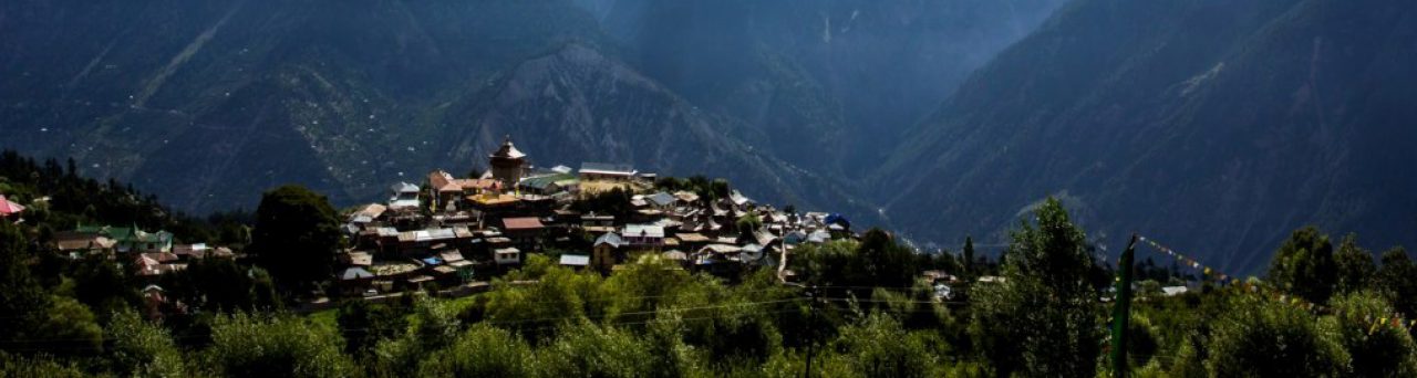
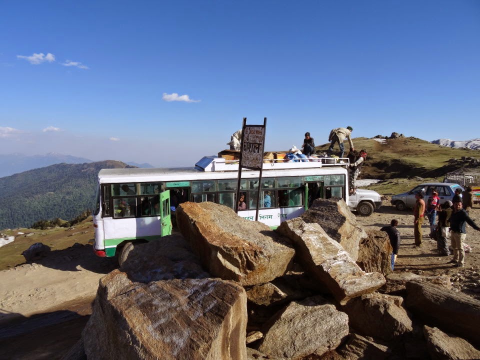
Dodra and Kwar – (डोड्रा और क्वार) are two beautiful villages nestled in remote part of Himalayas in state of Himachal Pradesh (India). Situated at a height of 2500 mts above sea level, both the villages of Dodra and Kwar are separated by River Rupin which is a tributary of River Yamuna. Recently (Year 2009) connected through a motorable road, though seasonal, this pocket retains a pristine beauty.
There are countless wild flowers and medicinal herbs, thick woods of flowering rhododendron, cedar and birch, waterfalls and fast-flowing streams. All this is set against a majestic backdrop of high peaks like the Sharangcha. The villages and their temples, are remarkable examples of local wood work skill and come packed with fascinating legends.
Dodra and Kwar are two villages on the opposite sides of the valley separated by Rupin river that merges into Tons river. It borders with Uttarakhand and is a famous trek from Naitwar as well. You can even cross Rupin pass from Sangla in Kinnaur to reach this region.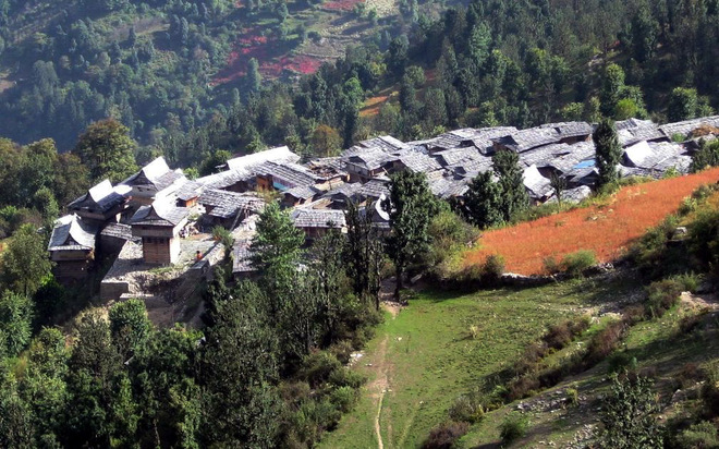
The 61-kilometre-long Larot-Kwar road passes through the scenic Chanshal pass at 12,600 feet above sea level. The unused Chanshal ski slopes are considered the longest in South Asia by experts.This is now expected to attract tourists in large numbers. Dodar Kwar, located in Shimla district, around 200 kilometre from here, remains covered in heavy snow for several months in a year.
The vegetation in the lower altitude of Dodra Kawar valley comprises of broad leaf trees and conifers are found in higher altitudes. However, the Chanshal top has only pastures and is devoid of trees, as the area is above the tree line. Out of the total geographical area 36,697 ha of Dodra-Kawar, about 35,178 ha comprises of forests, of which 3,767 ha is DPF (demarcated protected forests) and 31,411 ha forest area falls under UPF (undemarcated protected forests).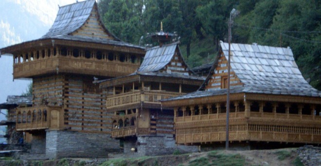
The forest area in this region is about 95 per cent. Limited population, lack of road facilities and slow rate of development are factors that are responsible for forest conservation in this area. Some forests in this area are considered as amongst the best forests in the state. Moru is the most favoured tree species in the area, as they have multiple uses in terms of fodder, fuel-wood. In addition to this, other tree species found in the area are Kimmu, Himbrane, Moldane, Pabun, Kunish, Safeda, etc. and there is a rich undergrowth in the form of shrubs and bushes that are indicative of a good forest type.
Chanshal
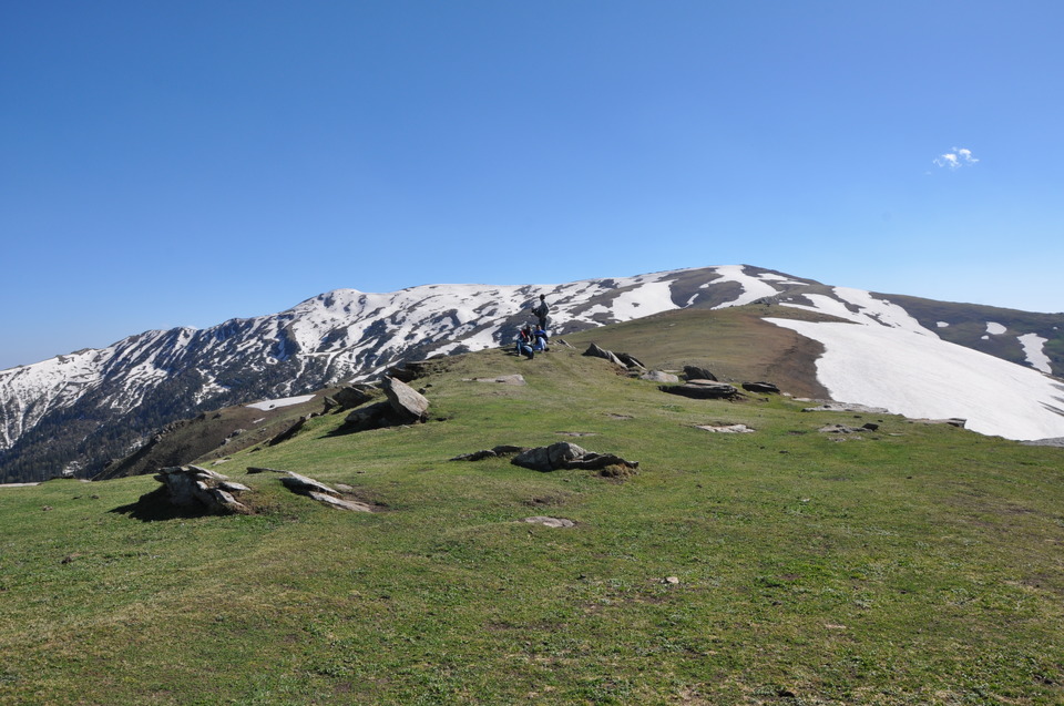
The highest mountain peak in Shimla hills, patient Chanshal (altitude 4,520 meters) is largely an unexplored gem that servers the nomadic appetite of travelers seeking adventure, beauty and some days of seclusion. When on the summit, it feels possible to touch snow clad peaks in the distance, and if one looks down onto the Pabbar valley, it appears like a painting of streams and brooks laden landscape that runs amuck into forest lands before discharging into Pabbar River.
Larot
Larot, the last village before Chanshal pass is almost 60 kms away from Dodra. Earlier Larot used be the road head for Dodra and Kwar villages.

The beautiful village of Dodra, with traditionally designed wood houses with slate roof. The houses remain warm in the long and freezing winters.